

Don't Miss


Most Read


Trending on GB News
The summer has so far been around one degree warmer than average, potentially putting it in the top 10 warmest UK summers on record.
The Met Office says although it may surprise those who have endured a far wetter and “duller” season than usual in London and south-east England, relatively high temperatures in Scotland and Northern Ireland have helped elevate this summer towards the top 10 on mean temperature.
In a statement, the Met Office says while it is still a few days off announcing a definitive ranking at the start of September, the UK’s mean temperature for summer was around one degree centigrade higher than average at 15.4C (59.7F).
Northern Ireland has so far had one of its warmer summers with a mean temperature of 15.0C (59F).
And the Met Office said Scotland’s figure was 13.8C (56.84F), which qualified as “notably warm”.
Amid last month’s heatwave, Northern Ireland broke its all-time record with a top temperature of 31.3C (88.3F).
It could still be close as to whether this summer hits the top 10.
The Met Office’s outlook up until Monday – the second-last day of summer – reads: “Often cloudy, cool with some light rain or showers for northern and eastern coastal areas. Elsewhere, dry with sunny spells. Warm in the west.”
Western areas, especially western Scotland, had also had far less rain than average, with Scotland so far recording just 62% of its average rainfall for the season at 188.1mm, and Wales 66% with 189.5mm.
By contrast, there has been an average across all areas of Greater London of 220.2mm of rain – 48% more than the long-term summer average, though still short of records.
Hampshire has had 245.2mm, or 49% more than average, Surrey 240.3mm, or 54% more than average, and West Sussex 250.9mm, 52% above average.
Dr Mark McCarthy, of the National Climate Information Centre, said: “Obviously there’s still time before the month and season is over, but summer so far is certainly looking drier and warmer than average.
“That’s despite some of the wet, dull conditions we’ve seen in the south-east in particular.
“Some of the flooding seen in London in July has seen some individual stations report almost twice their normal summer rainfall but the north and west of the country has experienced plenty of sunshine through June and July, although most of the country has been duller than average through August.”
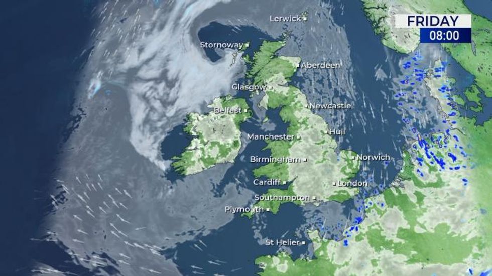
Here is today's forecast, and what to expect going into the weekend:
Today
Early fog and low cloud may persist in northwestern coastal areas but lifting inland. This leaves some cloudier zones with an isolated light shower but some warm sunny spells elsewhere. Feeling cool near breezier east coasts and in cloudier regions.
Tonight
Dry with variable amounts of cloud for most regions. Thicker low cloud and fog for some NW coastal areas. Scattered showers in the far southeast. Chilly in the clearer areas.
Saturday
Most areas dry with sunny spells and feeling warm by afternoon. Some eastern coasts cooler, the odd shower in the southeast. Low cloud and fog in coastal northwest UK.
Outlook for Sunday to Tuesday
Remaining fine and dry for most with the best of any sunshine and warmest temperatures in the west. Cloudier and cooler for eastern parts where it will be breezy