
Heavy snow warning: Britain to be battered by -12C 'nightmare' blizzards and a FOOT of snow THIS weekend
Heavy snow alert: Weather forecasters are warning a 'major event' will impact the UK on Sunday
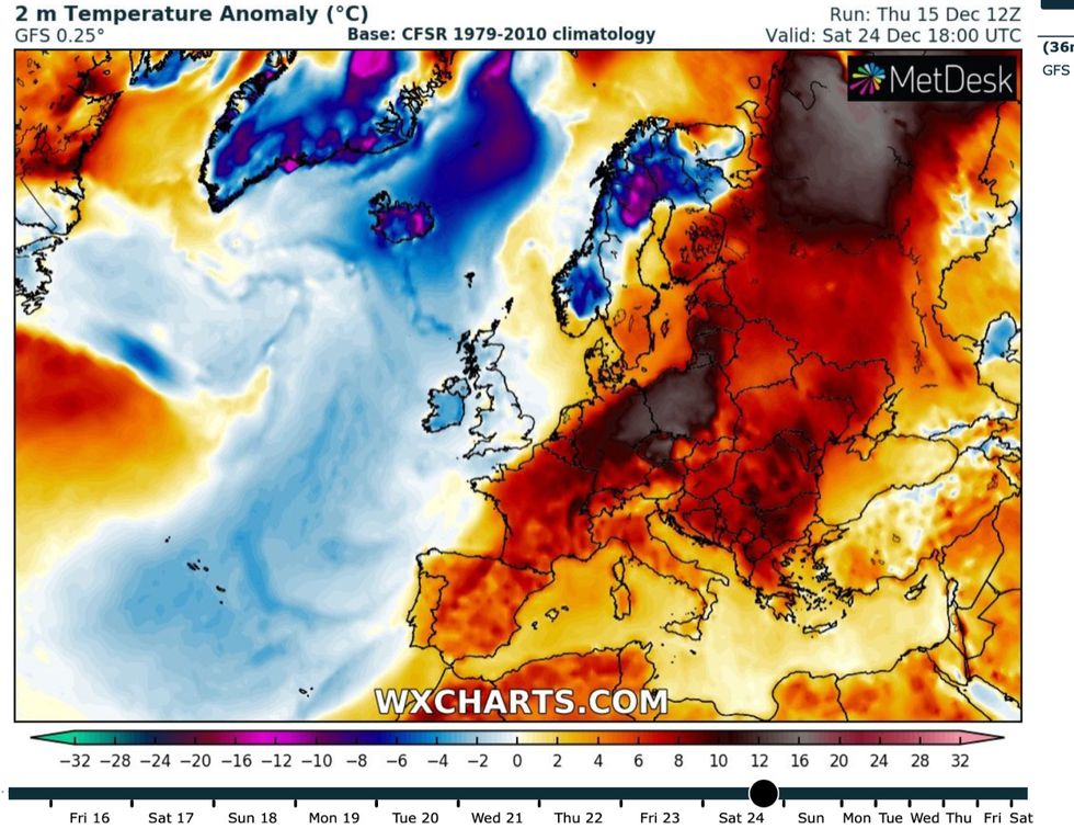
WX Charts

A MAMMOTH winter deluge dubbed "the Nightmare before Christmas" is about to bulldoze Britain as -12C blizzards bury swathes of the country under "feet-deep" snowdrifts.
The nation is braced for a major winter storm to plough in from the Atlantic on Sunday as hours of driving snow grind transport networks to a standstill.
Government alerts have been extended amid mounting fears extreme weather will trigger travel chaos and power cuts while leaving rural communities stranded under heavy snow.
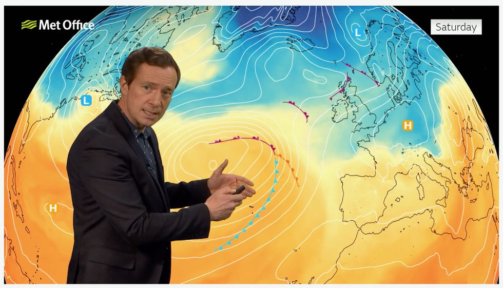
Met Office meteorologist Alex Deakin explains how the Atlantic low will pull in tropical air
UK Met Office
The whiteout will be driven by a complex tangle of weather fronts swept into Britain by a low-pressure cyclone loaded with moisture.
The churning vortex will unload torrents of snow in parts after crashing into cold air left behind from this week’s "Troll from Trondheim" Polar assault.
Jim Dale, a meteorologist for British Weather Services, said: “This event, if it comes off as expected, will be the result of a major system coming in from the southwest on Sunday, and we are looking at a nightmare before Christmas.
“A mess of weather fronts associated with a low-pressure system in the Atlantic will crash into cold air over the UK left from the Troll from Trondheim Arctic blast–the driver of the very cold weather over the past week or so.

Heavy snow warning: Forecasters say huge drifts are possible across much of the UK this weekend
PA
“Parts of the country, probably from the Midlands northwards, could see two or three hours of driving snow on Sunday.”
A more serious danger than the snow could be roads and pavements icing over from freezing rain downpours, according to Mr Dale, author of ‘Weather Or Not?’.
He said: “Freezing rain is going to be a real threat, and this may be more significant than the snow when it comes to transport.
“As rain hits freezing surfaces, it turns them into ice rinks, and this is going to be a safety issue where pavements have not been gritted.”

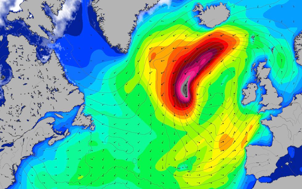
Snow alert: A churning low-pressure vortex will hurtle into Britain this weekend
MetDesk
Arctic conditions will grip Britain through the coming days before ‘tropical air’ dragged in by the cyclonic low-pressure system brings a milder feel.
Mr Dale added: “This weekend’s event will mark the last of the Troll from Trondheim, and Saturday is likely to be the last universal cold day before it turns briefly milder next week.”
Despite forecasts for milder temperatures in the short term, bookies are furiously axing the odds on festive snow. Ladbrokes is offering 2/1 for a White Christmas in Edinburgh, with Aberdeen also at 2/1, Birmingham 3/1, Manchester and Newcastle 7/2, Newcastle, Cardiff 4/1, and Liverpool and London at 4/1.
Spokesman Alex Apati said: “White Christmas odds have plummeted with the temperatures over the last few days, and we now look nailed on to see snow throughout the UK next Sunday."
Meanwhile, weather models show the mercury plummeting to -10C as scouring Scandinavian winds in parts make it feel closer to -12C.
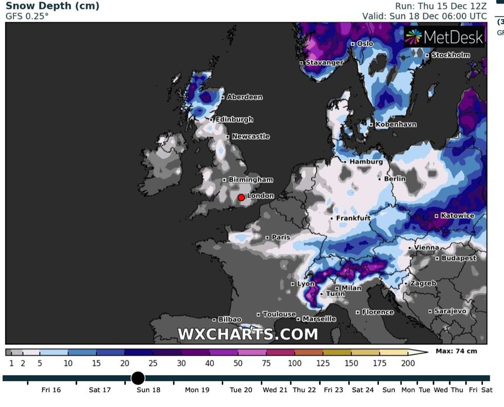
Snow is forecast to fall across much of the UK this weekend
WX Charts
The scouring Arctic winds this weekend threaten to whip up blizzards in parts of the country.
Exposed, rural regions risk being buried under piles of the white stuff as Britain falls into the jaws of another ‘significant snow event’.
James Madden, forecaster for Exacta Weather, said: “Sunday will see a large area of rain turning to snow as it pushes in and clashes with the colder air across Britain.
“It is still uncertain how far south rain or snow will fall, but some parts of south-west England, the Midlands, Wales, and Yorkshire could see some transient and heavy snowfall.
“Parts of Northern England and Scotland will bear the brunt of this and there will be some potential blizzard conditions at times.
Met Office weather warning: Forecasters say it will get 'ugly' this weekend before the thaw
MagicSeaweed
“This will be the second significant snow event in a matter of days for these parts with snowdrifts of several feet leaving roads blocked.”
The Met Office has issued a warning for snow and ice on Sunday across Scotland, and northern Britain. A separate warning for ice is in force across central and southern regions with only the West Country apparently dodging the assault.
Met Office meteorologist Alex Deakin said: “It could get pretty ugly with some fairly nasty conditions across the UK, especially on Sunday.
“Some tropical air is heading our way, and on Sunday much milder air swamps the UK.
“These weather fronts will bring wet weather up from the southwest and for a time will bring some heavy snow too.”


