
Heavy snow forecast: UK weather charts show exact date Britain to be blasted with deluge of snow
The Met Office have said there will be frost and freezing fog patches in the south on Saturday
WXCHARTS

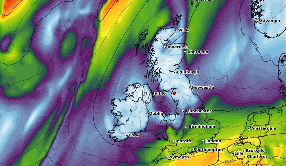
Heavy snow has been forecast for the UK as weather charts have shown the exact date Britain will be blasted with snow.
Earlier today, the UK Health Security Agency extended their level three Cold Weather Alert warnings until at least Saturday.
Temperatures in parts of Scotland will drop as low as -5C.
WXCHARTS
The alert is put in place when the country faces mean temperatures of 2°C and widespread ice and heavy snow.
The Met Office have not yet put any warnings in place but have said there will be frost and freezing fog patches in the south on Saturday which caused delays last weekend across the UK.
Charts show a weather system will bring heavy snow across the North of England towards the end of the weekend and into Monday next week.
Blizzard like conditions will travel in from Greenland bringing 2cm of snow to Scotland.

10cm of snow could settle in parts of Scotland
Jane Barlow
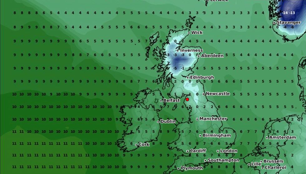
Despite temperatures rising largely across the UK, Scotland and parts of North England will remain in subzero temperatures, with highs of only 1C.
February looks to be another month of cold weather and snow as maps show up to 10cm of snow and temperatures plunging to -8C on February 10th.
Forecasters think the second wave of cold temperatures could be the last of a polar vortex which has trapped cold air in the Arctic.
Last week, James Madden, forecaster for Exacta Weather, said: “Recent weather models are starting to show a split of the Polar Vortex as a result of a Sudden Stratospheric Warming event.
“This could affect the UK weather by bringing us more snow and cold weather by the start of February, and this cold snap could be prolonged, perhaps delaying the start of the warmer spring weather.
“The SSW event could lead to a major disruption of the Polar Vortex, and that puts the UK at risk of much more cold and snowy weather through the coming weeks.”


